WYSIWYG

What You See Is What You Get. This is a journal blog, an explore-blog, a bit of this and that blog. Sharing where the mood takes me. Perhaps it will take you too.
Showing posts with label 2021-09-trip. Show all posts

Menootanaboot; The YAMster Leaves The Hutch - Last Leg

We awoke on Sunday morning at Alness with wetness yet again surrounding us. We had been looked after by the weather gods for our full day of travelling the neighbourhood on Saturday, but now the return journey was damp again. However, unlike the northward trip, it was more broken up and lots of non-drip spells to stop and appreciate the land. After a reasonably leisurely breakfast, we said our farewells to F and cousin M (and Gabby, of course!), making the decision as we drove out onto the A9 to follow that down as far as Aviemore, then cut across the country.
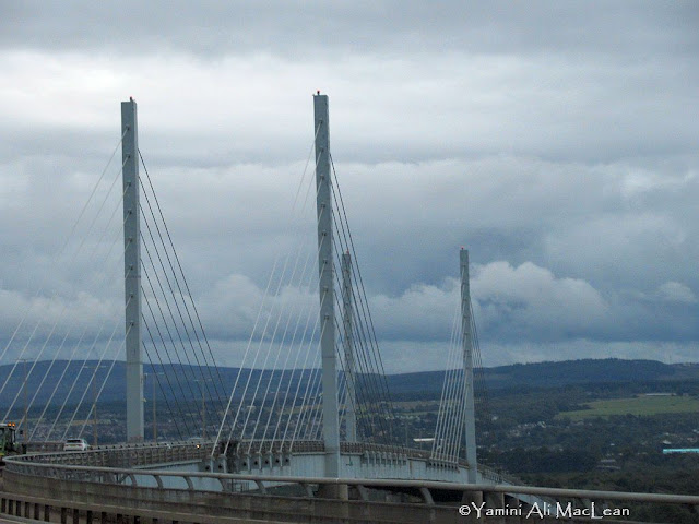
Kessock Bridge, over the Moray Firth - by Inverness.

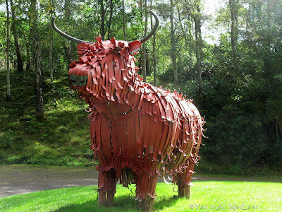
Below Aviemore, there is Newtonmore. The wee place is bypassed by the A9 now, but there is a wonderful rest stop called Ralia, in which one will find the Hairy Coo cafe and shop. The first was closed - the second was not. It was here that Hettie decided to make herself known to me, and thus I acquired yet another stuffed animal... sigh... 

If there had been a miniature of the fantastic, larger-than-life sculpture in the car park, I would probably have favoured that - but don't tell Hettie!!! There was no info to be found there about the sculpture, but a quick net search revealed that this was created by Kevin Paxton, Blacksmith; steel structure, galvanised and painted so should be rust free for many years. 

It irks me somewhat, however, that KP, Blacksmith, named his work "Fergus the Highland Coo." Fergus ought to be a Highland Bull and have his horns turned out flat or downward pointing. As this is clearly a cow from the upturned horns, she ought to have been named Fiona. Jus' sayin'...

There was a map which attempted to show where we were in relation to the various hill-sets of the area. I would not have minded a postcard or poster of this, but neither was available. That's a miss on their part, I'd say. Here's a rather poor photo of it. 


Directly after leaving Ralia (the wee red circle at bottom of that 'map') we headed off the main road and over to Loch Laggan, where there is a dam, built as part of the Lochaber Hydro-Electric scheme. From here we continued down through Fort William, waving to Ben Nevis with his head in the clouds, and into Glencoe. At the northern end is another grand we rest stop. We parked in there for half an hour and stretched our legs by walking to the bridge over the River Coe.

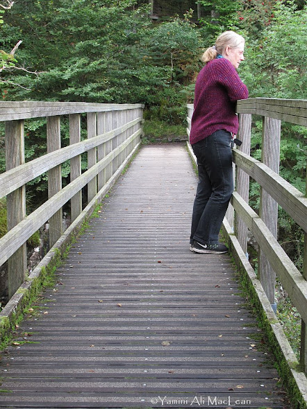


There was quite a roar in that water. Such places all over the planet give rest and respite...and capture the imagination, don't you think? From here it was on down to the next rest stop and a bit of food at Tyndrum at a well-known place called The Green Welly. Greasy-spoon style cafe food, but golly, that mac'n'cheese was just right at that point in the trip! There are also some excellent, hi-tek toilets there. It took us a moment to figure out that the taps also contained the blow-driers. It was the cause of much giggling once we got over the surprise!
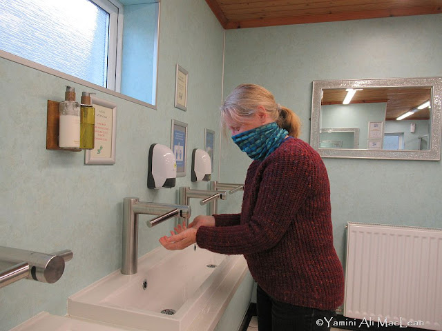

The photo doesn't really convey the hilarity - not helped by the mask, of course. I ought to have thought about filming it. A bit of levity to set us up for the final run down via Loch Lomond, round past The Cobbler and along Loch Fyne, where the sun was dimming fast. 


From the ridiculous to the sublime... we were in the door of the Hutch by seven-thirty of the evening and a quick cuppa and bit of toast were all we required. Mini-break was over and done!

There you have it folks... but here, just to round it off, is a wee bonus...


ADDENDUM Nov 1st 2021 - I was contacted by Rhys Davies (good Welsh name that!) of the Ben Nevis website requesting to have a link provided to it. Duly done! I had a nosy around and it is full of useful stuff to know about the Ben and also some fun posts relating to news and doings thereabout. Worth remembering if you are going to visit - or attempt a climb!!! Yxx

Me-Now-Views; Less Speak More Peek

Frae the Bonny Land... the Landscape Collection part three.

Ben Macdui as we race past Aviemore

Westside of the Cairngorms


Laggan Dam

Coire Sgriodain

Ben Nevis


Loch Lomond


Menootanaboot; YAMster Leaves The Hutch; 5th Leg

Am I stretching my legs too far??? Well, when you dinnae get oot an' aboot all that much, you have to milk yer chances!!! To catch all the legs, click the 'trip' label at the bottom of the post.

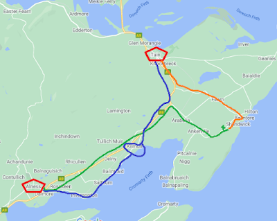
The map again...

We left Tain and headed back south via the blue line. That is to say, via the A9 main road until we turned off to the shore route at Barbaraville. This took us down via Kilmuir Easter, where F was determined we should stop.

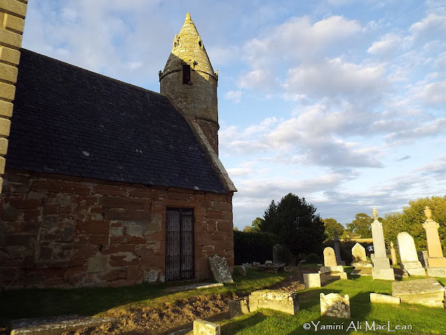
There is a church there that has fascinated her, but until this moment had not taken the time to stop and investigate. 

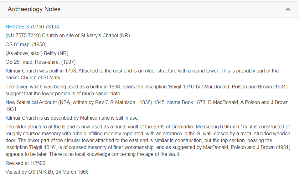
There are two distinct parts to the build, and she was sure that the steeple end must be very old. I rather think she might have thought it to be from the 13th or 14th century. I was not convinced and admit I rather thought more 18th or early 19th. As it turns out, though, and according to the Canmore website...


So 17th century was defined for the tower part and the 18th for the church itself.

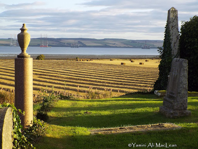
Not interested in that and just want to see the piccies? Well, the YAMster had to go have a nosey around, didn't she? Does love a good bit of sacred ground, does this gal. The views from it were not that bad either.


If you check back at last week's post and see the tollbooth roof, knowing it to have been built in the 1600s also, the similarity of the roof on this tower ought to have been a strong clue!!! Certainly worth the climb of those steps and a nosey around. And I could think of worse places to have one's final rest...

Now, this bit of the day is getting a post all of its own because it didn't stop here in the YAMster's brain! I had to find out more. There is an intriguing comment about the possibility of the lower part of the tower end being older than the 1616 marked date. To ascertain further info, I researched whether there was a Kilmuir Wester parish. 

Indeed there was! Although no longer existing other than some ruins and the graveyard. It is, however, a long way from Kilmuir Easter, being situated on the Moray Firth, quite close to Inverness. So all that links them is a similarity of name. Geographically, Easter is indeed further to the east than is Wester... However, that very interesting website states that K/Easter is likely to have had prebend (paid ministry) during the 15th century and likely earlier. The lower portion of this older part of the building shows a connection to known designs from medieval and Irish buildings.

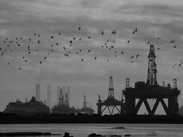
So that was all somewhat diverting. From here, we returned to Alness via Invergordon - past the vast and rather unattractive port area. It's a deep harbour, which is why it was initially chosen for the oil rigs too. I find the rigs a good deal more attractive than those floating hotels.

We spent another pleasant evening catching up with cousin M before a relatively early night because all that fresh air and exercise had us yawning by nine! Back next Thursday with the last leg...


Me-Now-Views; Less Speak More Peek

Here are more 'remainders' from the trip to Tain, and its surrounds...


Menootanaboot; YAMster Leaves The Hutch; 4th Leg

Remember, you can click the 'trip' label at the bottom to look back at the other 'legs'!

Continuing away from Hilton, we were headed for Tain, on the rim of the Dornoch Firth. Here's the map again.


We are now following the 'orange trail.' The drive itself is scenic - let's face it, there are not many drives in Scotland that don't yield lots of astonishingly lovely views, even in foul weather! Anyway, Tain was the place my father used to go to at the weekend as a teenager. It was the town to go for lads looking for a fun time! This is only a matter of scale. At that time, Invergordon was much smaller, and Tain had a picture house and a dance hall without lots of nosy elders. But I digress.

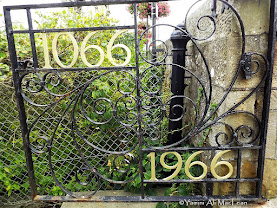
For those interested in such things, when thinking about ancient burghs in Scotland, often St Andrews comes to mind, as it holds the oldest university (est 1413). However, Tain lays claim to being the oldest Royal Burgh in this Bonny Land. The charter was granted in the year 1066 - yes, the year of the Domesday Book...[corr: As Gail points out in comments - that should be Battle of Hastings!] There are some extremely old structures in and around the town, but most of the buildings now date from the 19th century, and they are charming.


The main street was also very well decorated with all those fantastic hanging baskets. There is also a Royal Garden (which doesn't permit dogs, so we didn't explore it at length. I just popped in to get the deets from the board).


You might need to biggify that one if you wish to read it all - but the key point is the garden was opened in 1966 by the Queen Mother, and it was created to commemorate the 1066 connection. Then in 2009, the garden also featured on The Beechgrove Garden, a BBC Scotland program, when the team helped to turn it into a proper community garden. This is something else I will have to spend more time visiting on another tour!

Above the garden (and hiding behind Gabby and F in that shot of them) stands a monument...but first a gratuitous portrait of Mac1 and a closer look at those baskets!


The plaque tells you what you need to know about that. If the bust is a true likeness, Mr Murray was a handsome fellow, as well as being publicly useful in his short life!

Along the street from here, I was determined to find the building with the incredible fairy-tale roof. It is easily seen as one drives into the town, but it could not be easily seen from street level. When we came to a most imposing door, we realised this was the place, but I had to cross the street to get any kind of photograph worth having - although there were details close up that made for interest, too.


If you cannot biggify the info board, you can read something of the history on this link. However, the basics are that it was built in the 17th century but was ransacked by Cromwell's troops and had to be substantially refurbished in the 18th century. It has served as an administrative council and courthouse throughout.

After an hour of enjoying the street views and gazing into windows to see community notices and to assess the property situation of the area (it's more expensive than Dunoon...but cheap by main city standards), I treated us all to scampi and chips from the shop that DIDn't smell like it was cooking; very clean, very efficient and, we all agreed, exceptionally well-cooked chips! F drove us down to the shorefront, and we watched the sun lighting up parts of the firth where the sandy beaches that abound here glowed in the late light under the glowering clouds. 


Our day was not yet ended, but I leave it here and will pick up the little surprise we had on the return journey next Thursday.